
Map projection on a two-dimensional terminal with Go
Programming Snapshot – Go Map Projections

© Photo by Don Pinnock on Unsplash
While searching for a method to draw geodata right into the terminal, Mike Schilli discovers the wondrous world of map projections.
While I was working on hikefind, a command-line program that chooses a trail from a collection of GPX files with track points, for a recent issue [1], I got the idea of drawing the trail contours the program found in a terminal window. Unfortunately, a GPX file generated by an app such as Komoot or a Garmin tracker only contains geocoordinates as floating-point numbers. They refer to the points of the globe through which the trail passes (Figure 1).
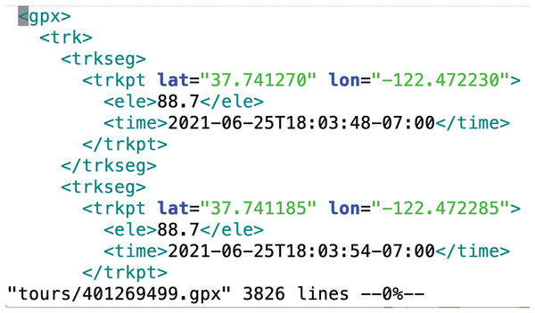 Figure 1: Geocoordinates in a GPX file.
These geopoints on a spherical surface now need to be converted to a two-dimensional coordinate system so that they look as natural as possible on a flat map. This problem was solved centuries ago. Any map, whether paper or digital, is based on the genius idea of projecting geopoints on the globe, which are available as latitude and longitude values, onto an XY coordinate system on a plane.
[...]
Buy this article as PDF
(incl. VAT)
Buy Linux Magazine
US / Canada
UK / Australia
Subscribe to our Linux Newsletters
Find Linux and Open Source Jobs
Subscribe to our ADMIN Newsletters
Support Our Work
Linux Magazine content is made possible with support from readers like you. Please consider contributing when you’ve found an article to be beneficial.

News
-
Gnome Developers Consider Dropping RPM Support
In a move that might shock a lot of users, the Gnome development team has proposed the idea of going straight up Flatpak.
-
openSUSE Tumbleweed Ditches AppArmor for SELinux
If you're an openSUSE Tumbleweed user, you can expect a major change to the distribution.
-
Plasma 6.3 Now Available
Plasma desktop v6.3 has a couple of pretty nifty tricks up its sleeve.
-
LibreOffice 25.2 Has Arrived
If you've been hoping for a release that offers more UI customizations, you're in for a treat.
-
TuxCare Has a Big AlmaLinux 9 Announcement in Store
TuxCare announced it has successfully completed a Security Technical Implementation Guide for AlmaLinux OS 9.
-
First Release Candidate for Linux Kernel 6.14 Now Available
Linus Torvalds has officially released the first release candidate for kernel 6.14 and it includes over 500,000 lines of modified code, making for a small release.
-
System76 Refreshes Meerkat Mini PC
If you're looking for a small form factor PC powered by Linux, System76 has exactly what you need in the Meerkat mini PC.
-
Gnome 48 Alpha Ready for Testing
The latest Gnome desktop alpha is now available with plenty of new features and improvements.
-
Wine 10 Includes Plenty to Excite Users
With its latest release, Wine has the usual crop of bug fixes and improvements, along with some exciting new features.
-
Linux Kernel 6.13 Offers Improvements for AMD/Apple Users
The latest Linux kernel is now available, and it includes plenty of improvements, especially for those who use AMD or Apple-based systems.