
Mapping the details
Tutorial – Map Machine and OpenStreetMap
Use Map Machine's icons to make the most of OpenStreetMap data and show as many map features as possible.
OpenStreetMap (OSM) [1] is an open source success story, a tool that every owner of any kind of computing device has surely used at least once, knowingly or not. This collectively designed digital map of the whole world is, in fact, integrated into services by the likes of Wikipedia, Amazon, Apple, Facebook, and countless other organizations. Besides being a lot of fun, knowing how to handle OSM maps or raw geographical data from OSM is one of those skills that can likely be useful for everyone, sooner or later. This is why I present Map Machine [2], a tool you can use – by combining its set of icons with raw OSM data – to create your own custom maps.
The Map Machine icon set aims to display as many map features as possible, because the original idea behind the project was to show all the richness of the OpenStreetMap data. Figure 1 shows just a small part of the complete icon set, and yet it covers features as diverse as barber shops, diving platforms, power lines, trellises, and mailboxes.
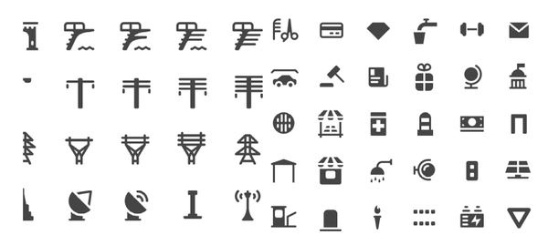 Figure 1: A small sample of the icons available with Map Machine.
[...]
Buy this article as PDF
(incl. VAT)
Buy Linux Magazine
Subscribe to our Linux Newsletters
Find Linux and Open Source Jobs
Subscribe to our ADMIN Newsletters
Support Our Work
Linux Magazine content is made possible with support from readers like you. Please consider contributing when you’ve found an article to be beneficial.

News
-
Ubuntu 26.04 Beta Arrives with Some Surprises
Ubuntu 26.04 is almost here, but the beta version has been released, and it might surprise some people.
-
Ubuntu MATE Dev Leaving After 12 years
Martin Wimpress, the maintainer of Ubuntu MATE, is now searching for his successor. Are you the next in line?
-
Kali Linux Waxes Nostalgic with BackTrack Mode
For those who've used Kali Linux since its inception, the changes with the new release are sure to put a smile on your face.
-
Gnome 50 Smooths Out NVIDIA GPU Issues
Gamers rejoice, your favorite pastime just got better with Gnome 50 and NVIDIA GPUs.
-
System76 Retools Thelio Desktop
The new Thelio Mira has landed with improved performance, repairability, and front-facing ports alongside a high-quality tempered glass facade.
-
Some Linux Distros Skirt Age Verification Laws
After California introduced an age verification law recently, open source operating system developers have had to get creative with how they deal with it.
-
UN Creates Open Source Portal
In a quest to strengthen open source collaboration, the United Nations Office of Information and Communications Technology has created a new portal.
-
Latest Linux Kernel RC Contains Changes Galore
Linux kernel 7.0-rc3 includes more changes than have been made in a single release in recent history.
-
Nitrux 6.0 Now Ready to Rock Your World
The latest iteration of the Debian-based distribution includes all kinds of newness.
-
Linux Foundation Reports that Open Source Delivers Better ROI
In a report that may surprise no one in the Linux community, the Linux Foundation found that businesses are finding a 5X return on investment with open source software.